
استاذ مشارك Structural Interpretation of the Aeromagnetic Data Anomalies on the Eastern Part of Sana’a Basin, Yemen
الشريط الجانبي للمقالة
محتوى المقالة الرئيسي
الملخص
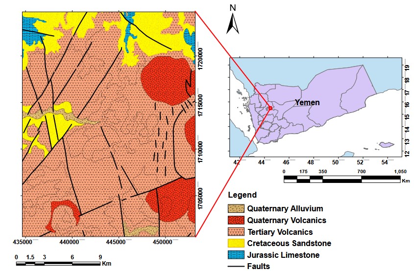
The studied area is located in the east of Sana’a, Yemen, between latitudes 1700000 - 1720000 N and longitudes 430000-450000 E. Geological and aeromagnetic maps of the region (Sheet 13G, scaled at 1:250,000) are among the data used. By analyzing the available aeromagnetic data, the current work seeks to comprehend the regional subsurface structures and their contributions to surface geological formations. A number of analysis methods, such as regional/ residual separation, spectral analysis and Euler deconvolution have been used to critically interpret the aeromagnetic map. According to the findings, two tectonic events have primarily influenced the region throughout its geological past. The region’s tectonic framework Is largely determined by the tectonic activity of the late Precambrian (Najd Rift System, trending from NW to SE), which has experienced reactivation along with the opening of the Red Sea. Another more recent tectonic event (during the Cenozoic, trending from NE to SW) is linked to the emplacement of a trap volcanic chain and the opening of the Red Sea and the Gulf of Aden. 2D spectrum analysis and 3D Euler deconvolution techniques were used to calculate the depth of the magnetic anomaly sources, which were determined to be between less than 250 and 3086 m.
التنزيلات
تفاصيل المقالة

هذا العمل مرخص بموجب Creative Commons Attribution-NonCommercial-NoDerivatives 4.0 International License.